By Markian Melnyk, Realtor
Although a relatively small state, Maryland has a surprisingly long coastline – about 7,719 miles of tidal shoreline according to the Maryland Geological Survey. This includes Maryland’s Atlantic coast and the huge length of Chesapeake Bay inlets, rivers, and creeks. The land directly bordering these waters, and to varying degrees inland, has flood risk.
The risk is physical damage from storm surges and heavy rainfall, but also the risk to property values when flood insurance becomes prohibitively expensive or maybe unavailable. A home that cannot be insured cannot get mortgage financing, which limits the pool of potential buyers and depresses property values. An average annual cost of home insurance in Florida of over $8,000, due in part to severe weather exposure, illustrates how weather risks can significantly impact housing costs.
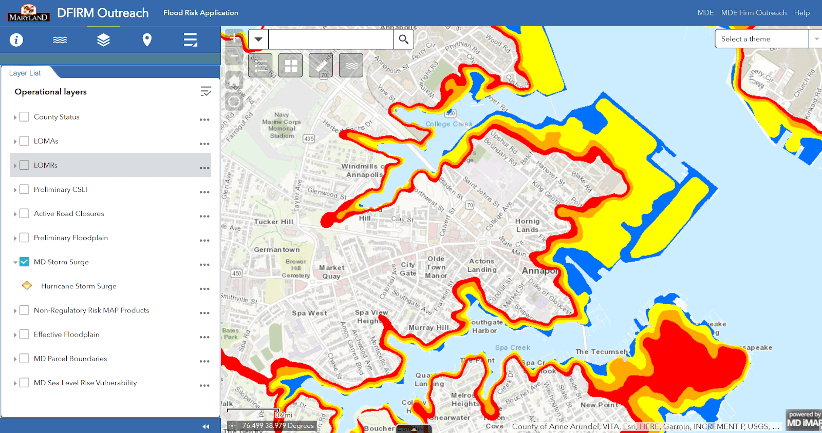
Before you buy, consult flood maps to better focus your search. The image below from mdfloodmaps.net shows the extent of possible hurricane storm surge in Annapolis. You can zoom in on these maps to discover whether a listing is in the danger zone or to identify areas to avoid and those that lie at a safe elevation.
Also consult FEMA’s Flood Map Service Center. Type in the address of a property that you’re considering. If it falls within the blue shaded area on the map (Zones A or V) that shows a 1% annual chance of flooding. FEMA calls these Special Flood Hazard Areas and a federally backed mortgage on a property in these areas must have flood insurance. Finally, remember that most regular home insurance does not provide flood coverage. Flood insurance is additional. The maps are updated regularly, so it’s a good idea to build a margin of safety into your home search to hopefully avoid the need to purchase flood insurance in the future.